


Snowpack 133% of normal looks great but below average precipitation is of greater concern
Consistent snowfall this spring has helped boost Central Oregon snowpack to 133% of normal, a surprising jolt after a lackluster winter that saw below-average snowpack levels.
Snowpack has steadily increased from just six weeks ago when the Upper Deschutes Basin was only 54% of normal.
But while the snowpack has given Bend a pretty backdrop, the region’s drought is still far from over. Recent snowfall is not the best indication of how much snow is actually in the mountains, said Kyle Gorman, region manager for the Oregon Water Resources Department.
Gorman explains that in a typical year, warm temperatures cause rapid snowmelt by mid-May, which lowers snowpack. So any small storms that drop a little snow can cause the snowpack percentage to skyrocket well above normal for this time of year. Even cold temperatures that prevent melting will cause the percentages to rise compared to what is average for this time of year.
Precipitation is the more important number to watch as it more accurately indicates how Central Oregon is faring against the drought, said Gorman. Precipitation for the water year is 96% of normal, up from 81% of normal six weeks ago but still below average.
“We haven’t recovered this year. We are still below average,” said Gorman.
Central Oregon reservoirs will need two or three consecutive years of above-average precipitation and snowpack for a recovery to occur, said Gorman.
“If the reservoirs drain down to a minimum this year, they won’t fill next year no matter what. I can tell you that,” he said.
Deschutes National Forest spokesperson Jean Nelson-Dean added that dry conditions still exist at lower elevations and fire danger remains a threat as the region heads toward summer. The La Niña weather pattern is expected to create dry conditions from June through August, she said.
“These dry conditions along with anticipated windier conditions and persistent drought will keep Central Oregon at a higher risk for wildfires than normal,” said Nelson-Dean. “Ongoing drought will really elevate these conditions in July and August.”
A bright spot can be found at Mt. Bachelor ski area, which is expected to remain open for skiing through May 29, said company spokesperson Dustin Fletcher. Historically, Mt. Bachelor has been able to stay open as late as the July 4 weekend.
A roundup of the area’s reservoirs shows water levels that remain at historic lows. Wickiup Reservoir, which started the irrigation season at 55% of capacity, has since fallen to 48% of capacity.
Wickiup’s draining rate is slower compared to a year ago due to decreased water allotments for farmers in Jefferson County. Water managers are taking unprecedented steps that curtail the delivery of water this year in order to make water available until the end of the irrigation season. Cooler temperatures and recent precipitation also allow dam managers to slow the release of water from Wickiup.
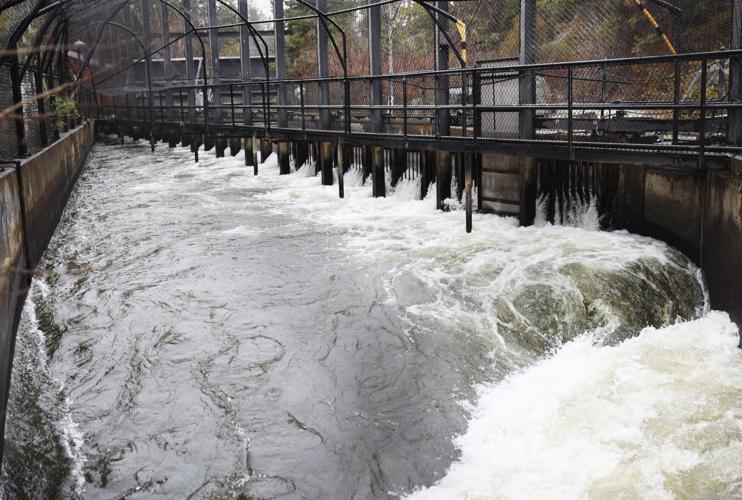
At Wickiup dam, the release of water on Tuesday was just 837 cubic feet per second compared to 1,134 cfs on the same date a year ago.
Other reservoirs at critically low levels include Crescent Lake (11%), Prineville Reservoir (31%), and Ochoco Reservoir (21%).
Larry O’Neill, associate professor at Oregon State University’s College of Earth, Ocean and Atmospheric Sciences, said the forecast for the next two weeks is for cool and wet conditions to potentially continue.
“After that though, signals are on the horizon for an anomalously warm and dry pattern to set up, which may take us into summer,” said O’Neill.
O’Neill said a possible impact of continued La Niña conditions is the tendency for a weaker southwest monsoon, which may give Central and Southeastern Oregon less summer thunderstorm activity, particularly in late July and August.
“This may be a mixed blessing with less lightning but also less summer rainfall,” said O’Neill. “This has been the case the last two summers and could be something to look out for this summer as well.”