


This article was published on: 04/7/23 9:06 AM
What if floodplain soil could soak up water in early spring and then release it back to the river at colder temperatures later in the summer when aquatic wildlife and irrigators need it most?
Scientists from Oregon State University-Cascades together with the Crooked River Watershed Council are testing that hypothesis on the upper Crooked River.
OSU Hydrologist Skuyler Herzog says channelizing has degraded the rivers over the years creating what he describes as a whiplash between deluge and drought.
Herzog wants to explore what the area might gain by allowing the river to meander again, or as landowners say, “put the crook back in the Crooked River.”
“Can we restore the natural connection of the river back to the valley,” said Herzog. He hypothesizes allowing flow back onto the floodplains will slow the water down instead of flushing through the channel, and may keep the water cool while the soil holds onto it until the water seeps back into the river system.
Testing the hypothesis
Chris Gannon, director of the Crooked River Watershed Council, emphasizes that no one will move any water until this study is complete and discussed by stakeholders.
“We’ll collect data in the floodplains,” Gannon said, “See what capacity they have to hold water.”
This feasibility study, funded by a $75,000 grant from the Oregon Watershed Enhancement Board, needs to answer a raft of questions. How much water would the floodplain store? How much of that water would return to the river system? Where? When? At what temperature?
Herzog and the CRWC have enlisted participation from eight landowners along a total of 25 miles of riverfront property. One particular landowner plays a key role.
“We’re working with one landowner who is flood irrigating,” says Herzog. “We’re not changing anything about his practices. We’re using that flood irrigation field to study this concept in a real floodplain.”
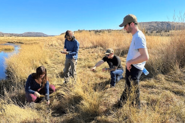
The study involves taking soil core samples and driving in a series of shallow observation wells called piezometers to measure groundwater levels, and tracking evaporation and plant water use.
“We’re monitoring the soil properties, groundwater properties as well as stream levels,” said Herzog, “and tracking how fast the floodplain fills and drains.”
They’ll also use LiDAR (laser imaging, detection and ranging) to measure topography and floodplain connection along the broader 25-mile project reach.
“We will have two different conceptual designs: one if everyone is on board, another individual landowner specific, actions individual landowners could take,” said Herzog.
Actions could include lowering berms, filling in the stream bed where it has eroded, sometime by two to three meters, and adding log jams and other structures to allow the river to flow wider across floodplains.
The maps serve only as a discussion tool for landowners, who will then be able to decide whether to pursue restoration actions. The CRWC does not have regulatory authority to tell property owners what to do.
According to the terms of the grant, this study ends in 2026.
“We could have data before the end of this project,” said Gannon. “By 2025, we could have enough field data to launch a small pilot project.”
Who does this study help?
This study has the most direct impact for landowners along the upper Crooked River above the Prineville Reservoir. A canyon contains much of the Crooked River directly below the reservoir, hence fewer floodplains. The concept, however, has much broader implications.
“There is some scientific debate about whether (re-meandering streams) balances flows,” said Herzog. “That’s the goal of this project, to get folks the information they need.”
Results will vary depending on topography and the types of soils, but stakeholders across the country, especially in Western states, ask this question. Studying the Crooked River could help others answer the question for themselves and give them methods to study their own watersheds.
“(This study) is about getting clarity to the decision makers,” says Herzog.
Local investment in floodplain research
“Everyone looks at the state of the river at present and believes it could be much better than it is,” said Herzog. “(This study) could be a win-win for everyone.”
Collaborators on this project range from the landowners themselves, to the watershed council, the Nature Conservancy, Deschutes Land Trust, the Deschutes River Conservancy, and more.
“A lot of folks see a positive vision of what this area could look like,” said Herzog. “I already see pronghorn antelope, bald eagles, golden eagles. With the Painted Hills formations too, there is a foundation worth building on. The shared vision of the project team is for a healthier river valley with productive farms and ranches, healthy riparian forests, and thriving fish and wildlife.”