
Bend Bulletin: Snowpack ‘hotspots’ better than basin-wide mapping for predicting water
By Kyle Odegard
Adding new snowpack monitoring stations at strategic locations would be better at predicting water supply in the western U.S. than basin-wide mapping — and it would be less expensive — according to a new study.
“Measuring snow in the right places can benefit forecasts more than measuring it everywhere,” said lead author Mark Raleigh, an Oregon State University snow hydrologist.
“This could guide our thinking about how snow monitoring might evolve to become more optimal for water forecasting,” he added.
For about 100 years, water supply forecasting has relied on snow water equivalent measurements at ground-based stations, but these are sparse and sample a small area.
“What we already have is very good at predicting water supply,” Raleigh said.
It could be more accurate, helping inform business decisions for farmers and ranchers. “Having an idea of how much water there’s going to be is very important,” Raleigh said.
That’s led to interest in costly basin-wide mapping from airborne surveys or future satellite missions.
Snowmelt is a key water source for about 2 billion people globally, including in many agricultural regions such as the Pacific Northwest and California.
On average, about half of the water in western streams is driven by snowmelt. “It could be more or less, depending on where you’re at. The path water takes isn’t always straightforward,” Raleigh said.
“Our findings can help water agencies make informed decisions for more efficient water monitoring,” he said.
For the study, researchers analyzed more than 20 years of snow estimates and streamflow data across 390 snow-fed basins in 11 states.
Their analysis found the location and importance of “hotspots” — areas where snowpack isn’t currently measured but is especially predictive of water supply.
Hotspot monitoring can improve water supply predictions in most basins, with typical gains of 11% to 14% compared to an estimated 4% from basin-wide mapping of snow.
Basin-wide mapping includes extensive areas of shallow snow that don’t generate much runoff. Snow hotspots are generally in high elevations with more snow accumulation.
Monitoring networks may not be optimized for water supply prediction for some basins, and also may become less reliable with climate change.
“Focusing new snow measurements at hotspots is a cost-effective alternative to basin-wide surveys, with potential for more accurate water forecasts,” Raleigh said.
“This efficiency is critical as we move into a time when budgets are tightening and the demand for reliable water information remains high,” he added.
Getting a new monitoring station is still expensive, however, and station recordings are needed for years to create meaningful forecasts.
Relative to other areas in the West, it’s difficult to make good water availability forecasts with snow in Oregon and parts of Washington.
Raleigh said that’s good news, however, as there’s more room for improvement with hotspot monitoring.
Read more at: https://bendbulletin.com/2025/09/17/snowpack-hotspots-better-than-basin-wide-mapping-for-predicting-water/
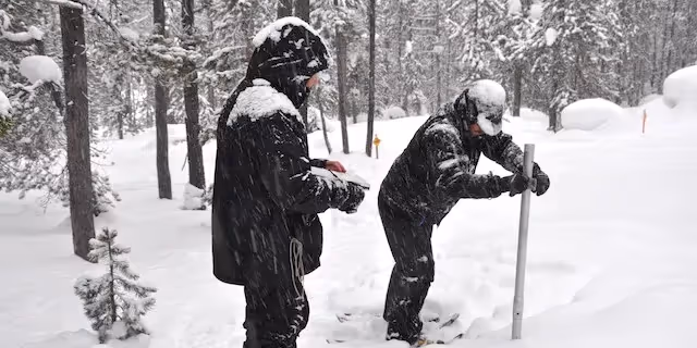
Photo: A crew measures the Oregon snowpack in this file photo. A new OSU study says snowpack monitoring stations at strategic locations would be better at predicting water supply in the western U.S. than basin-wide mapping. (Courtesy NRCS)
