
Reaches
Crooked River

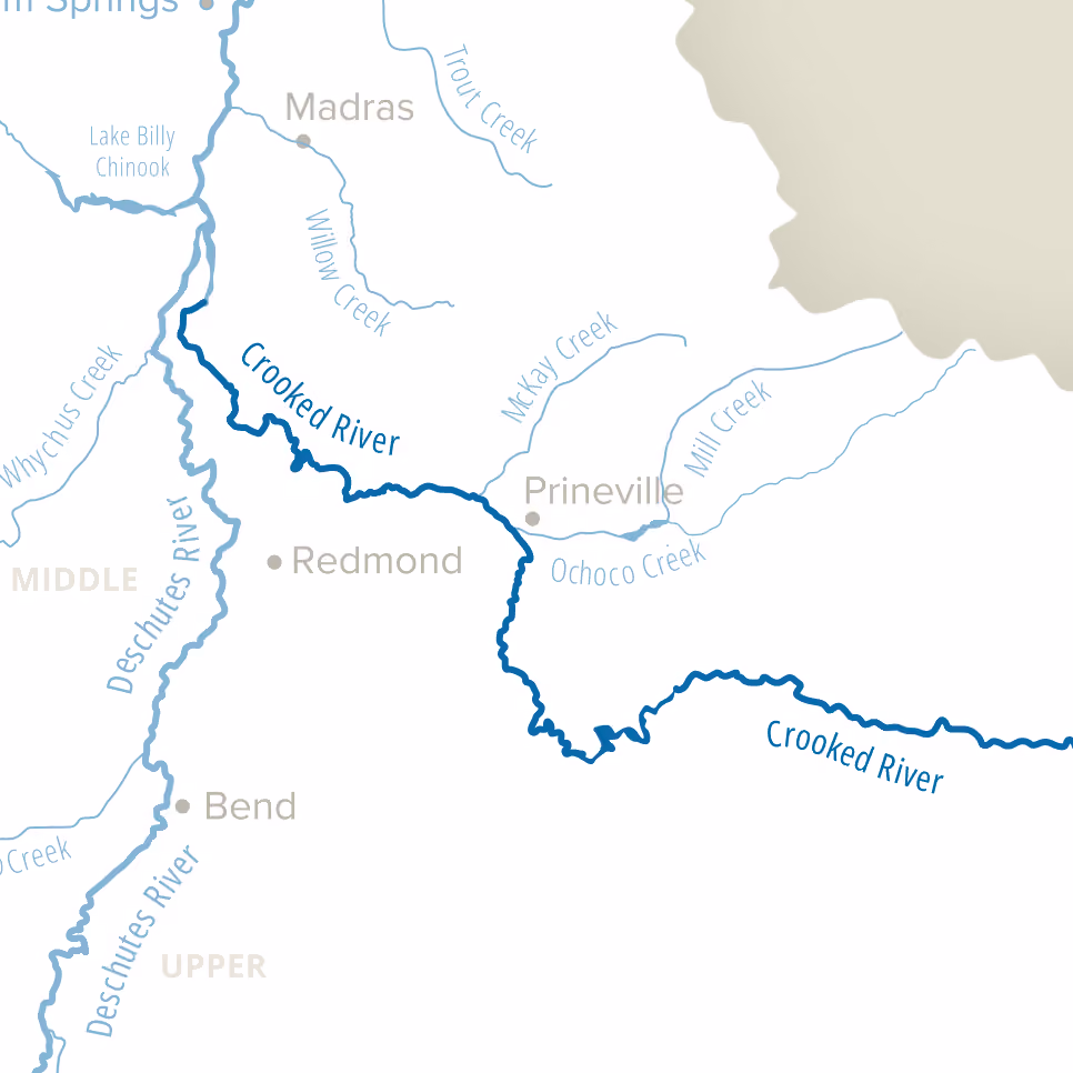
The Beautiful Crooked River and its Tributaries Flow Through the Southeastern Portion of the Deschutes Basin
Our work focuses on the 73 miles of the Lower Crooked River below Bowman Dam and its two tributaries, McKay Creek and Ochoco Creek.
Salmon and steelhead have recently been reintroduced into these reaches. Our two major projects are the McKay Creek Water Rights Switch, which aims to restore natural streamflows to McKay Creek, and the North Unit Minimum Flow Agreement, which restores streamflow in the low flow section below river mile 28 that runs through Smith Rock State Park.
Projects:
- McKay Creek Water Rights Switch with OID
- Up to 11.2 cfs will be protected instream, restoring the natural hydrograph
- Monitoring surface water, groundwater, macro-invertebrates, and riparian vegetation.
- North Unit Minimum Flow Agreement
- Crooked River Water Quality Partnership
- Initiative focused on decreasing human caused nitrogen in the Lower Crooked River
- Initiative focused on decreasing human caused nitrogen in the Lower Crooked River
- Annual instream water leasing
Wildlife Inhabitants:
Progress:
(Goal: 80 CFS)
Challenges:
Solutions:
