
Bend Bulletin: Metolius headwaters remain near historic lows
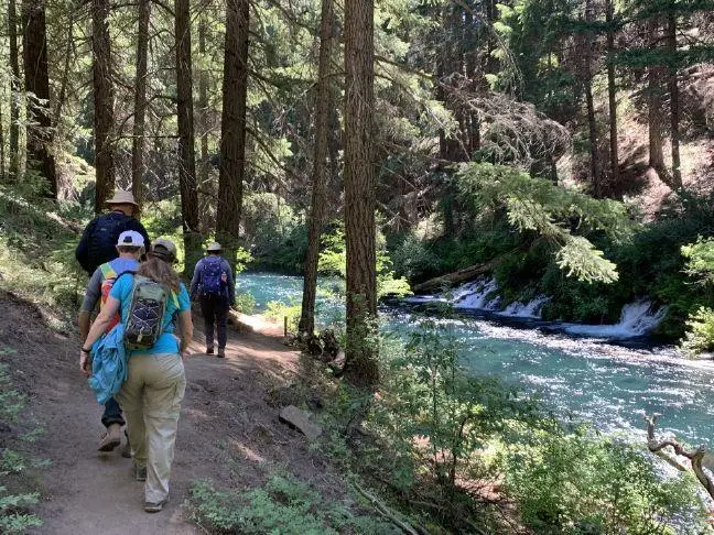
Photo credit: Hikers walk past springs that help keep water levels stable on the Metolius River. (Courtesy)
Written by Michael Kohn
The headwaters of the Metolius River continue to flow near historic lows, with new measurements showing only modest improvement despite several years of near-average snowpack in the Cascades.
The Oregon Water Resources Department measured the Metolius headwaters at 58.31 cubic feet per second on June 11, up slightly from 55.6 cubic feet per second measured in June 2023. The spring, however, remains well below the 121 cubic feet per second recorded in June 2015.
State measurements show headwater flows have generally trended downward since 2015. The river dropped below 80 cubic feet per second in 2021 and has remained near record lows since then.
Fish spawning grounds
The Metolius, one of Oregon’s largest spring-fed rivers, emerges from a spring complex near Camp Sherman and is sustained primarily by groundwater rather than seasonal snowmelt. Snowmelt and rainfall infiltrate the volcanic rocks of the Cascade Range, where groundwater moves through underground aquifers before emerging at large spring complexes, such as the Metolius.
The headsprings and spring-fed tributaries to the Metolius create important spawning grounds for chinook salmon, bull trout, redband trout and kokanee. These fish require consistent sources of cold and clear water to complete different stages of their lives.
Because the river is fed by groundwater stored in volcanic aquifers, it responds slowly to changes in precipitation.
Sluggish recovery
State hydrologists say the sluggish recovery reflects years of below-average precipitation rather than conditions from any single winter.
“Total precipitation is more important than snowpack for flow at the headwaters of the Metolius,” said Michael Coiner, a spokesperson for the Oregon Water Resources Department. “Flow at the Metolius headwaters is dependent on the cumulative impact of annual precipitation from the preceding five to 10 years.”
Drought years like this one impact that total precipitation. Nearly 30% of Deschutes County is currently experiencing extreme drought with the remaining 70% in severe drought, according to the U.S. Drought Monitor. The county declared a drought emergency in February.
Decade-scale droughts
Erick Burns, a research hydrologist with the U.S. Geological Survey, said research on comparable spring-fed rivers shows recovery from prolonged drought also occurs over long time periods.
“Spring flow rates vary decadally in response to decadal-scale wet and dry periods,” Burns said. “This means that many years of drought will require many wet years to get the system back to the long-term average.”
Data from the Santiam Pass SNOTEL station show that 11 of the past 12 years have received less total precipitation than the 1991-2020 median. Although precipitation totals from 2023 through 2025 were somewhat higher than the exceptionally dry 2020-21 water year, they remained below historical averages.
As a result, groundwater stored within the volcanic aquifer continues to recover slowly, limiting the amount of water feeding the river’s spring system.
Fall River impacted
The Metolius is not alone in its slow recovery. The department said other spring-fed rivers near the Cascade Range, including the Fall River near Sunriver, are showing similar long-term declines associated with reduced groundwater recharge.
A major tributary to the Deschutes River, the spring-fed Fall River, located 25 miles south of Bend, closely mirrors the natural flow of the Deschutes basin.
Mean daily flow in the 12-mile long Fall River is currently about 104 cubic feet per second, compared with about 115 cubic feet per second during the same period in 2016.
Climate change impacts
The department said prolonged below-normal precipitation remains the primary cause of the diminished flows, though warmer temperatures and changes in the timing and type of precipitation could also affect future spring flows.
Burns backs up the notion that climate change could also have long-term effects on spring-fed rivers beyond reducing streamflow.
“As annual average air temperature increases, spring temperatures will increase, likely on a timescale of 10-50 years and longer, as warmer land surfaces conduct heat into the groundwater,” he said.
If more winter precipitation falls as rain instead of snow, recharge entering the aquifer could also become warmer, potentially raising spring temperatures and affecting cold-water habitat for fish.
Jerry George, a fish biologist with the Oregon Department of Fish and Wildlife, said long-term, year-over-year trends in precipitation will impact fish and the eco-systems upon which they depend.
“When streamflow’s are reduced it tends to lead to slower, warmer water, and fish congregating in the few remaining deep pools where parasites and diseases can spread,” said George. “Stressful conditions and warmer water temperatures also tend to favor non-native species which may outcompete our cold water adapted native species for resources.”
